
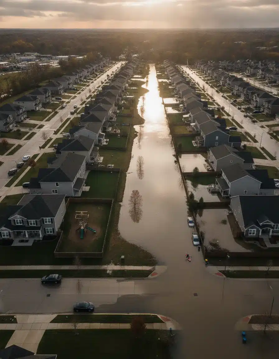
Your FEMA flood zone is the single label that controls whether you must buy flood insurance, how high your foundation must sit, and what disclosure you owe a buyer. High-risk zones starting with A or V carry mandatory insurance for federally backed mortgages. Moderate and low-risk zones carry no mandate but still produce more than 20% of all NFIP claims, according to FEMA.
Your zone also sets building elevation minimums, triggers substantial-improvement rules during renovations, and can shift without warning when FEMA updates its Flood Insurance Rate Maps. Knowing your zone before a storm, not after, is the difference between a covered claim and a devastating out-of-pocket loss.

What FEMA Flood Zones Actually Mean
Part of our Restoration SEO: The Complete Restoration Company SEO Guide. Want it done for you? See our restoration SEO and marketing agency.
FEMA divides every mapped parcel in the country into one of three broad risk tiers based on annual flood probability. High-risk Special Flood Hazard Areas face at least a 1% annual flood chance. That figure translates to a 26% probability over a 30-year mortgage. These zones carry letters A or V. Moderate-risk areas labeled Zone X (shaded) fall between the 100-year and 500-year floodplains, carrying a 0.2% annual chance. Low-risk areas marked Zone X (unshaded), or the legacy label Zone C, sit outside the 500-year floodplain entirely.
The term “100-year flood” trips up most homeowners. It doesn’t mean a flood that happens once a century. It means a flood with a 1% chance of occurring in any given year. That probability doesn’t reset after a flood happens. Two 100-year floods can hit the same neighborhood in the same decade, or none at all for 150 years. Probability doesn’t follow a calendar.
Zone D designates areas where flood hazards exist but FEMA hasn’t completed mapping yet. Treat Zone D seriously. A future study may reclassify that land as high-risk, instantly triggering insurance requirements and building rules. Buying in Zone D without flood insurance is a calculated gamble on an incomplete dataset.
How does a FEMA flood determination work?
A flood determination is a formal lookup, usually ordered by a lender at closing, that identifies which FIRM panel covers your parcel and which zone applies. The determination uses your legal property description, not just your address. Results come back on a standard form (SFHDF). Lenders are required by federal law to order a determination before funding any federally backed loan on improved property. You can run your own informal lookup at msc.fema.gov using FEMA’s Flood Map Service Center.
What is the difference between a floodplain and a flood zone?
The floodplain is the physical land area that floods during a base flood event. The flood zone is the map label FEMA assigns to that land. They describe the same geography from different angles. FEMA floodplain regulations govern what you can build and how you must build it within mapped floodplains. The zone label triggers the insurance mandate. Both terms appear in local ordinances and mortgage documents, often interchangeably, but they carry distinct legal meanings.
High-Risk Flood Zones Explained
Zone A marks Special Flood Hazard Areas where FEMA hasn’t yet done detailed hydraulic analysis. No Base Flood Elevations appear on the map. Mandatory insurance applies. Building must meet local floodplain ordinances, but without a published BFE, both insurers and contractors work from less precise data. Zone A designations often appear on older maps awaiting a full study update.
Zone AE is the most common high-risk label. Detailed hydraulic modeling has produced published BFEs. According to Clovered, Zone AE carries a 26% chance of flooding over a 30-year mortgage and typically borders inland water bodies or the Intracoastal Waterway. The existence of a published BFE makes insurance pricing precise and building elevation requirements clear.
Zone AO covers shallow sheet-flow flooding averaging 1 to 3 feet on sloping terrain near rivers and streams. Water moves fast even at shallow depths, increasing structural pressure on foundations. BFEs are determined. Building requirements focus on elevating the lowest floor above the expected depth of flow.
Zone AH applies to flat areas where water ponds rather than flows, also at depths of 1 to 3 feet. BFEs are provided. Poor drainage is the common thread. Site grading and foundation design must prevent water from collecting around the structure during a base flood.
Zone AR flags areas with temporarily elevated risk because a nearby flood-control system, a dam or levee, has been decertified and is being rebuilt. Mandatory insurance still applies, but rates may be lower than other high-risk zones because partial protection remains during reconstruction. Once the project completes, FEMA remaps the area, typically moving it to a lower-risk designation.
Zone A99 covers areas protected by a federally authorized flood-control project that’s nearly complete. Insurance rates reflect the lower future risk profile. The zone converts after project completion.
What is flood zone AR, and is it different from AE?
Yes, they’re different. Zone AE reflects current, ongoing high risk based on natural geography and hydrology. Zone AR reflects temporary high risk created by a gap in engineered flood protection. An AR designation means a levee or dam that used to protect you has failed or been decertified, and a new or repaired system is under construction. Insurance is mandatory in both zones, but AR premiums are often discounted to reflect the protection that will exist once construction finishes. Always verify the construction timeline. Projects run long.
Want more customers from Google & AI search?
Get a free SEO audit of your site — see exactly what to fix first.
Coastal High Hazard Zones: V and VE
Zone V identifies coastal SFHAs where wave action compounds the flooding threat but no BFEs have been determined. The V stands for velocity. Waves reaching significant heights during storm surge create forces far beyond what standing floodwater exerts. Oceans and large lakes both generate V Zone conditions.
Zone VE adds published BFEs to the coastal high-hazard picture. According to FEMA, Zone VE is where wave action and fast-moving water can cause extensive damage during base flood events. Building requirements in VE zones are the strictest in the flood zone system. Structures must be elevated on pilings or columns so waves can pass beneath the lowest floor. Fill is prohibited as structural support because storm surge erodes it. Enclosed areas below BFE require breakaway walls designed to collapse under flood force without damaging the floor above.
Salt water damages materials faster than fresh water. Erosion undermines pile foundations over time. V Zone insurance premiums run higher than inland A Zone premiums because the hazard profile is more severe. FEMA encourages V Zone construction standards inside the Limit of Moderate Wave Action (LiMWA) zone, a Coastal A area where wave heights reach 1.5 to 3 feet. Many local codes make that recommendation a requirement.
Are FEMA regulations for coastal homes stricter than inland rules?
Yes, significantly. Inland A Zone construction must elevate the lowest floor to BFE, use flood-resistant materials below BFE, and install flood vents in any enclosed space below the lowest floor. V Zone construction adds pile or column foundations, breakaway walls, wave and scour analysis, and a prohibition on fill as structural support. Some coastal municipalities layer additional setback requirements, erosion buffers, and dune preservation rules on top of FEMA’s minimums. Check both the federal standards and the local ordinance before designing any coastal structure.

Moderate and Low-Risk Zones: X, B, and C
Zone X (shaded) sits between the 100-year and 500-year floodplains. The 0.2% annual flood chance equals roughly 5% probability over 30 years. No federal insurance mandate applies, but the risk is real. First Street Foundation data shows more than 20% of NFIP claims originate from these zones, largely because most owners skip coverage.
Zone X (unshaded) sits outside the 500-year floodplain entirely. Risk is lowest here. But a single intense storm can overwhelm drainage systems. New upstream development changes runoff patterns. Aging culverts and storm sewers fail. Yesterday’s safe street floods today. Annual premiums in unshaded Zone X run $400 to $600, a small price against a $25,000 average loss from one inch of water.
Zone B and Zone C are legacy labels from older FIRMs now being replaced by shaded and unshaded Zone X on updated maps. Zone B equals shaded X (moderate risk). Zone C equals unshaded X (low risk). If your map still shows B or C, your area is overdue for a FIRM update. The risk profile is the same; only the label differs.
What is flood zone B, and do I need insurance there?
Zone B is a moderate-risk designation from older FEMA maps, now equivalent to shaded Zone X on updated FIRMs. It sits between the 100-year and 500-year floodplains. Federal law doesn’t require flood insurance for mortgages in Zone B, but lenders can require it anyway. The 5% probability of flooding over a 30-year loan is low enough that most owners skip coverage, yet high enough to produce a large share of total NFIP claims nationally. Getting a quote is free. In most Zone B locations, coverage costs less than $700 a year.
What is a 500-year flood zone in plain terms?
It’s an area FEMA maps as facing a 0.2% annual flood probability. Shaded Zone X and the older Zone B label both describe it. That 0.2% chance adds up to roughly a 5% risk over 30 years, about the same odds as rolling a 20 on a single die. The term “500-year” implies the flood only happens once every 500 years on average. That average can compress. Two 500-year events can hit a watershed within years of each other. The label signals moderate risk, not immunity.

All FEMA Flood Zone Types at a Glance
| Zone | Risk Level | Annual Flood Chance | BFE Published? | Insurance Mandatory? | Key Hazard |
|---|---|---|---|---|---|
| A | High | 1% | No | Yes (federal mortgage) | Riverine or sheet flooding |
| AE | High | 1% | Yes | Yes (federal mortgage) | Riverine flooding with studied BFE |
| AO | High | 1% | Yes (depth) | Yes (federal mortgage) | Shallow sheet flow, 1-3 ft |
| AH | High | 1% | Yes | Yes (federal mortgage) | Shallow ponding, 1-3 ft |
| AR | High (temporary) | 1% while decertified | Yes | Yes (federal mortgage) | Decertified levee or dam |
| A99 | High (transitional) | 1% until project done | Yes | Yes (federal mortgage) | Flood control project nearly complete |
| V | Coastal high | 1% | No | Yes (federal mortgage) | Wave action and storm surge |
| VE | Coastal high | 1% | Yes | Yes (federal mortgage) | Wave action, surge, erosion |
| X (shaded) / B | Moderate | 0.2% | No | No (recommended) | Between 100-yr and 500-yr floodplain |
| X (unshaded) / C | Low | Under 0.2% | No | No (optional) | Outside 500-yr floodplain |
| D | Undetermined | Unknown | No | No (but advisable) | Unmapped flood hazard |
How to Find Your FEMA Flood Zone
FEMA’s Flood Map Service Center at msc.fema.gov gives you free access to official FIRMs. Enter your address, zoom in, and read the zone label printed on the map panel. You’ll also see BFE contour lines in AE zones and the panel’s effective date. Preliminary maps show proposed changes before they become official, giving you advance notice of a zone shift.
Your local floodplain administrator, usually housed in the building or planning department, maintains detailed maps and interprets zone implications for specific parcels. Title companies run formal flood determinations at closing. Licensed surveyors prepare Elevation Certificates documenting your lowest floor elevation relative to BFE. Private services like FloodFactor.com layer climate risk data on top of FEMA maps for a broader picture.
What is a DFE flood designation, and how does it affect construction?
DFE stands for Design Flood Elevation. It’s the elevation to which a local community or building code requires construction, and it’s often set one or more feet above BFE as freeboard. Communities that participate in FEMA’s Community Rating System earn insurance discounts for residents by adopting stricter standards, including higher DFEs. When a local code sets DFE at BFE plus two feet, your contractor must build to that higher mark even though FEMA’s minimum only requires BFE. Always check the local ordinance. The DFE, not just BFE, controls your permit approval.
What elevation requires flood insurance?
The insurance mandate ties to your flood zone, not your elevation. Any federally backed mortgage on property in a high-risk A or V zone requires flood insurance regardless of how high your structure sits. Elevation affects your premium, not whether you must buy. A building elevated three feet above BFE in Zone AE still requires insurance if the mortgage is federally backed. It just pays a much lower premium than a building at or below BFE. An Elevation Certificate documents the difference and gets your premium adjusted accordingly.
FEMA Building Requirements in Flood Zones
New construction in high-risk zones must meet local floodplain management ordinances aligned with FEMA’s minimum standards under 44 CFR Part 60. The lowest floor, including basement, must be elevated to at least BFE. Most local codes add one to two feet of freeboard above that. Foundation types in A zones must be flood-resistant: open pier, pile, column, or post systems work. Closed foundations like slabs or crawlspaces require engineered flood vents that equalize hydrostatic pressure automatically.
Substantial improvement rules catch renovation projects. When improvement costs exceed 50% of the pre-improvement market value of the structure, the entire building must come into compliance with current flood zone standards. That can mean elevating an entire house at a cost of $30,000 to $100,000 or more. Always get a cost-versus-value assessment before pulling renovation permits in a flood zone.
V Zone requirements are stricter. Pile or column foundations only. No fill as structural support. Breakaway walls in any enclosed space below BFE. Erosion and scour analysis proving pile depth is adequate for design flood conditions. These rules exist because wave action during a coastal storm removes material and undermines shallow foundations rapidly.
What are FEMA’s rules for new construction in a floodplain?
FEMA’s minimum standards require that new residential construction in A zones be elevated so the lowest floor sits at or above BFE. Non-residential buildings can be floodproofed to BFE using watertight walls and shields instead of elevation, but only where local codes allow it. Any enclosed area below BFE in a residential building can only be used for parking, building access, or storage. Flood vents in those enclosures must meet the one square inch of net open area per square foot of enclosed floor area standard, or you can use engineered vents. Check 44 CFR 60.3 for the complete federal baseline, then check your local ordinance for anything stricter.
What are FEMA’s foundation requirements in high-risk zones?
In A zones, foundations must support the structure under flood and buoyancy conditions. Open systems (piers, posts, piles, columns) are preferred because water flows through rather than against them. Crawlspace foundations can work if properly vented and elevated. Basement floors in A zones must still meet BFE elevation, which often makes basements impractical. In V zones, pile or column foundations are mandatory. The piles must penetrate deep enough to resist scour, the erosion of soil around the pile base during wave action. FEMA’s coastal construction guidelines, published as FEMA P-55, give engineers the technical standards for pile sizing and embedment depth.
What is FEMA’s no-rise requirement?
Any development in a regulatory floodway, the channel of a river or stream plus adjacent land reserved for flood discharge, must not raise the base flood water surface elevation. That’s the no-rise requirement under 44 CFR 60.3(d). A licensed engineer must certify that your proposed development produces no increase in BFE, shown through hydraulic modeling. Encroachments that would raise the flood level require a FIRM revision through a Conditional Letter of Map Revision before permits can be issued. Violating the no-rise standard exposes communities to losing their NFIP eligibility, which would void flood insurance for every property owner in that jurisdiction.
Flood Insurance Requirements and Costs by Zone
High-risk zones A, AE, AO, AH, AR, A99, V, and VE all trigger mandatory flood insurance for federally backed mortgages. Lenders enforce coverage as a loan condition from day one through payoff. Selling the property transfers that requirement to the next buyer with a federally backed loan. Dropping coverage mid-loan is a loan default condition.
Moderate-risk Zone X (shaded) and low-risk Zone X (unshaded) carry no federal mandate, but private lenders can impose their own requirements. Many conventional lenders require coverage for any property within one mile of a water body or within the 500-year floodplain, regardless of FEMA’s zone label. Ask your lender directly before assuming no mandate applies.
NFIP premiums depend on zone, BFE, your building’s elevation relative to BFE, foundation type, and the presence of a basement. A building in Zone AE at BFE typically pays $900 to $1,800 per year for the NFIP maximum of $250,000 in building coverage. That same building elevated two feet above BFE might pay $400 to $700. Zone X premiums often run $400 to $600. Private flood insurance now competes with NFIP in many markets and can offer higher limits and sometimes lower rates. Get both quotes before deciding.
FEMA Map Changes and How to Appeal Your Zone
FEMA updates Flood Insurance Rate Maps every 5 to 10 years. Updates reflect new development changing runoff patterns, better LiDAR elevation data, hydraulic modeling improvements, and infrastructure additions or failures, according to ClimateCheck. When a preliminary map drops, affected property owners get a 90-day comment and appeal period before the map becomes effective.
You can challenge your designation through a Letter of Map Change. A Letter of Map Amendment corrects map errors, specifically when a survey proves your property sits above BFE and was incorrectly included in the SFHA. A Letter of Map Revision applies when physical changes like grading, fill, or a new drainage channel have actually reduced your flood risk. Both require professional documentation.
A LOMA typically needs an Elevation Certificate from a licensed surveyor showing your lowest adjacent grade above BFE. A LOMR requires hydraulic and hydrologic engineering studies showing the physical change and its effect on flood elevations. Processing takes 60 to 120 days. Combined engineering and survey costs run $1,500 to $5,000. A successful LOMA eliminates your insurance mandate and can cut premiums by $1,000 or more per year, paying back the investment within months.

Pursue an appeal if your survey shows your property sits above BFE, if fill or regrading moved you out of the floodplain, if drainage improvements changed local flood behavior, or if a map error placed you in the wrong zone. Don’t pursue one if the map accurately reflects physical conditions. FEMA will reject an appeal that isn’t backed by field-verified data.
Frequently Asked Questions
What does it mean if my house is in Zone AE?
Zone AE means your property sits in a high-risk Special Flood Hazard Area with a 1% annual flood probability, which equals a 26% chance over a 30-year mortgage. FEMA has determined Base Flood Elevations through detailed hydraulic analysis. You need flood insurance if you carry a federally backed mortgage. New construction must be elevated to at least BFE. Your premium depends directly on how far your lowest floor sits above or below that BFE line.
Can my flood zone change?
Yes. FEMA updates Flood Insurance Rate Maps every 5 to 10 years based on new development, improved modeling, and infrastructure changes. A property can shift from low-risk Zone X into high-risk Zone AE or vice versa. FEMA notifies affected property owners before changes take effect, giving you a window to buy insurance at pre-change rates. Map changes directly affect your insurance requirement, building rules, and resale value.
Do I need flood insurance in Zone X?
Federal law doesn’t require it for Zone X mortgages, but FEMA reports that more than 20% of National Flood Insurance Program claims come from moderate and low-risk zones. Annual premiums in Zone X typically run $400 to $600. FEMA puts average losses from just one inch of water at about $25,000. Climate change and upstream development keep increasing flood risk even in zones that once seemed safe.
How do I get out of a flood zone?
You can’t move your land, but you can challenge an incorrect designation through a Letter of Map Amendment if a licensed surveyor confirms your property sits above Base Flood Elevation. If you’ve placed fill or made drainage improvements, a Letter of Map Revision may apply. Elevating your structure above BFE won’t change the zone label, but it can cut premiums sharply. Engineering and survey costs typically run $1,500 to $5,000, but annual savings often justify the investment quickly.
What is Base Flood Elevation?
Base Flood Elevation is the water surface height FEMA predicts during a base flood event, the one with a 1% annual chance of occurring. It’s measured in feet above sea level. Every foot your lowest floor sits above BFE earns a meaningful premium discount under NFIP rating rules. A surveyor prepares an Elevation Certificate documenting your building’s elevation relative to BFE. That certificate costs $400 to $800 but can save thousands per year in premiums.
What flood zones require flood insurance?
High-risk zones starting with A or V, specifically Zone A, AE, AO, AH, AR, A99, V, and VE, trigger mandatory flood insurance for any federally backed mortgage. Lenders enforce this as a loan condition from closing through payoff. Moderate-risk Zone X (shaded) and low-risk Zone X (unshaded) carry no federal mandate, but individual lenders and local requirements may still demand coverage. Private lenders can require insurance in any zone regardless of FEMA designation.
What is a 500-year flood zone?
It’s an area FEMA maps as facing a 0.2% annual flood probability. Shaded Zone X and the older Zone B label both describe it. That 0.2% chance adds up to roughly a 5% risk over a 30-year mortgage. The term implies the flood only happens once every 500 years on average. That average can compress. Two 500-year events can hit a watershed within years of each other. The label signals moderate risk, not immunity, and First Street Foundation data shows a significant share of NFIP claims originating from these zones.
How often should I check my flood zone?
Check your zone at least once a year when FEMA releases map updates, and always check before buying property or starting a major renovation. Substantial-improvement rules kick in when renovation costs exceed 50% of a building’s market value, so knowing your zone before you pull permits matters. Also check after large development projects near your property change local drainage. FEMA’s Flood Map Service Center at msc.fema.gov shows both current effective maps and pending preliminary maps at no cost.
Take Action on Your Flood Risk Before the Next Storm Hits
Start at msc.fema.gov and confirm your current flood zone. If you’re in a high-risk A or V zone, get an Elevation Certificate from a licensed surveyor. That single document controls your insurance premium and supports any appeal you may need to file. If you’re in Zone X, get a flood insurance quote anyway. At $400 to $600 a year, it costs a fraction of the $25,000 average loss from one inch of water.
If you bought your home without checking the flood zone, do it today. Map changes happen without advance media coverage. You could currently be in a proposed high-risk zone and not know it yet. Your local floodplain administrator will show you preliminary maps and explain the timeline.
For homeowners who’ve already experienced flooding, the zone label affects how your restoration claim is handled, whether your contractor can legally rebuild at the original elevation, and whether your permit will require full compliance with current flood standards. PushLeads works with restoration companies across flood-prone markets and sees these issues arise repeatedly after major storm events. Knowing your zone before you sign a restoration contract protects you from permit surprises mid-project.
If you run a restoration company and need to rank for these flood zone terms in your local market, PushLeads builds the content and technical SEO infrastructure that puts contractors in front of homeowners at the moment they search. See exactly where your visibility stands with a free teardown at seo.pushleads.com/audit or call 828-348-7686.
Keep Reading
Want more customers from Google & AI search?
Get a free SEO audit of your site — see exactly what to fix first.
Your path · Restoration SEO
Keep going: read these next

- Up nextVideo Marketing for Restoration Companies: YouTube, TikTok, and Before/After Content
- Indoor Air Quality Testing After Restoration: A Complete Homeowner Guide
- Air Duct Cleaning After Restoration: When It Matters and What It Costs




Want this done for you?
Scan your site. See the gaps. Decide with numbers.
- Rankings, Google Business Profile and site-speed teardown
- Report lands in your inbox in about a minute
- No obligation · 4.9 from 67 Google reviews
 Continue reading
